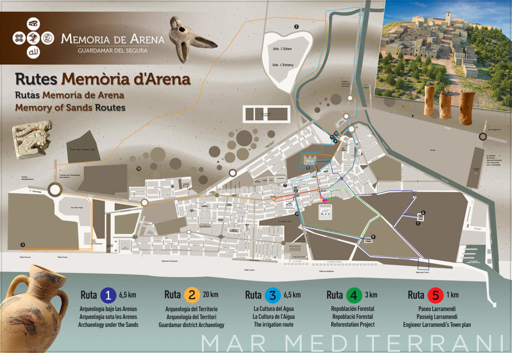
RUTA 1 (color blanco): ARQUEOLOGÍA BAJO LAS ARENAS. (Distancia: 6,36 km).
MAG (Museo Arqueológico de Guardamar), Castillo de Guardamar, La Fonteta (ciudad fenicia) y Rábita Califal (monasterio islámico).
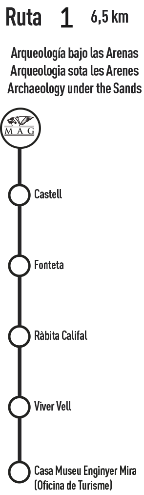
RUTA 2 (color marrón): ARQUEOLOGÍA DEL TERRITORIO. (Distancia: 19,66 km).
MAG (Museo Arqueológico de Guardamar), La Fonteta (ciudad fenicia), Rábita Califal (monasterio islámico), Castillo de Guardamar, Cabezo Pequeño del Estaño (yacimiento fenicio) y El Moncayo.
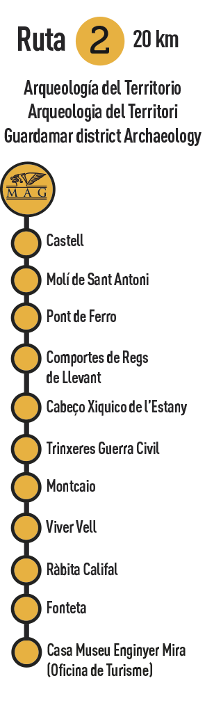
RUTA 3 (color azul): CULTURA DEL AGUA. (Distancia: 6,57 km).
MAG (Museo Arqueológico de Guardamar), Molino de San Antonio, Puente de Hierro, Compuertas de Riegos de Levante, Cenia del Río Seco y Casa-Museo Forestal Ingeniero Mira (Oficina de Turismo).
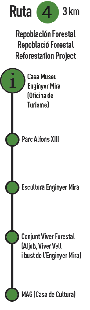
RUTA 4 (color verde): LA REPOBLACIÓN FORESTAL DE LAS DUNAS. (Distancia: 2,86 km).
Casa-Museo Forestal Ingeniero Mira (Oficina de Turismo), Parque Alfonso XIII, Escultura Ingeniero Mira, Conjunto del Vivero Viejo (Aljibe, Casa Forestal y Busto del Ingeniero Mira) y MAG (Museo Arqueológico de Guardamar).
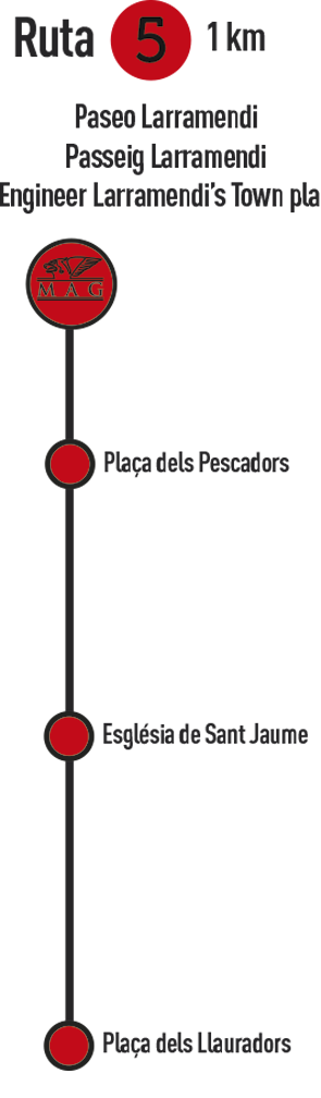
RUTA 5 (color rojo): PASEO LARRAMENDI. (Distancia: 0,86 km).
MAG (Museo Arqueológico de Guardamar), Trazado neoclásico de Larramendi: Plaza de los Pescadores, Iglesia Santiago Apóstol y Plaza de los Labradores.
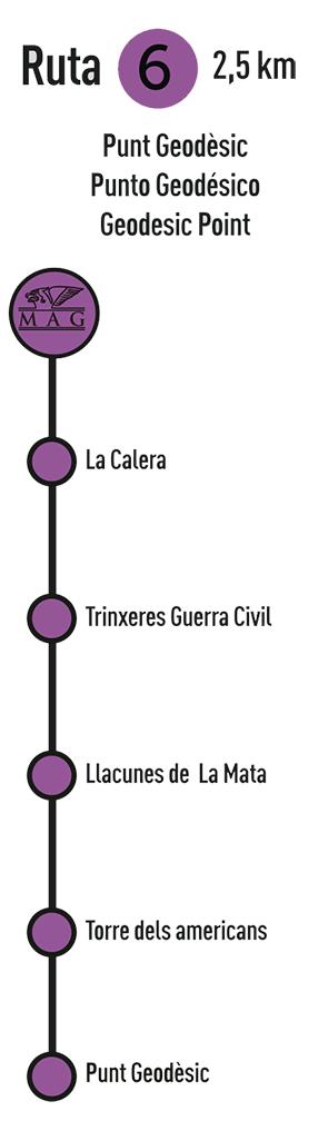
RUTA 6 (color morado): PASEO GEODESICO. (Distancia: 2,50 km).
La Caleta, Trincheras Guerra Civil, Lagunas de la Mata, Torre de los Americanos, Punto Geodésico
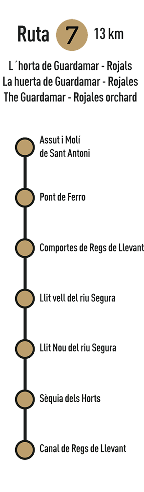
RUTA 7 (color crema): PASEO La huerta de Guardamar. (Distancia: 13,00 km).
Azimud y Molino de San Antonio, Puente de Hierro, Compuertas de Riegos del Levante, Cama vieja del Rio Segura, Cama nueva del Rio Segura, Acequia de la Huerta, Canal de riegos del Levante